

Rounds Of Heavy Rain To Soak Texas And Louisiana
Periods of heavy showers and thunderstorms are expected across southern and southeastern Texas into Louisiana today into Wednesday, and this will likely lead to flooding concerns across the region.
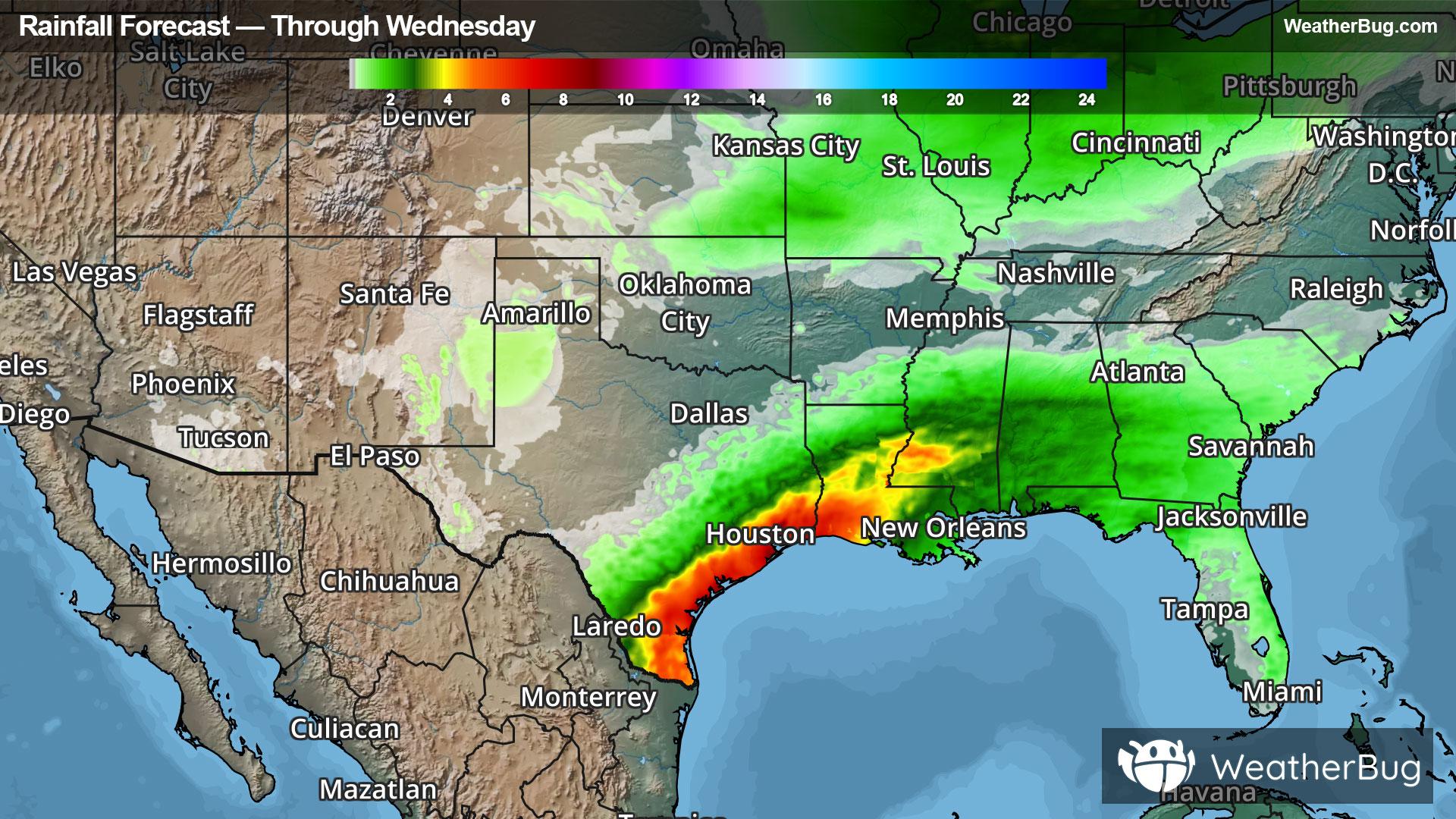
A decaying stalled front and a developing area of tropical low pressure emerging from northeastern Mexico will tap into plentiful moisture from the Gulf today and Wednesday causing locally heavy showers and thunderstorms in southern and southeastern Texas into Louisiana. The heavy rainfall will likely lead to flooding issues each day. Remember to "Turn Around, Don't Drown!" if you see a flooded roadway.
Rain totals of 3 to 5 inches will be most common across these states through Wednesday, while locally higher amounts up to 8 to 10 inches cannot be ruled out. There is even some potential for this low pressure area to become a tropical depression or storm later today or Wednesday, though uncertainty remains on if this happens due to land interaction.
Flood Watches remain in effect across all of southern and southeastern Texas into Louisiana and parts of southern Mississippi. Cities under the watches include Houston and San Antonio, Corpus Christi and Brownsville, Texas, New Orleans and Shreveport, La. and Jackson, Miss.
Make sure to know the difference between a watch and a warning should they be issued. A "watch" means that conditions are favorable for severe weather to occur, and to be on alert for any rapidly changing conditions. A "warning" means that severe weather is imminent, and you should act fast to remain safe.